For this hike, we drove 25 minutes from our apartment in Mittenwald to Garmisch-Partenkirchen, most famous for hosting the 1936 Olympics. The village is nestled at the base of the Zugspitze, Germany's tallest mountain. Of course we considered going up the Zugspritze instead, since we were right there. However, we wouldn't have been able to do much hiking there: even without a 6-year old, the ascent typically takes two days, and we weren't about to leave Frankie behind. There is a gondola that we could have ridden almost to the summit, but scaling a ladder is required to reach the actual summit. We weren't sure if this would be safe or accessible for Frankie, so we decided to pass on Zugspritze, and hiked Wank Mountain instead. Wank is on the other side of the Garmisch-Partenkirchen valley, and
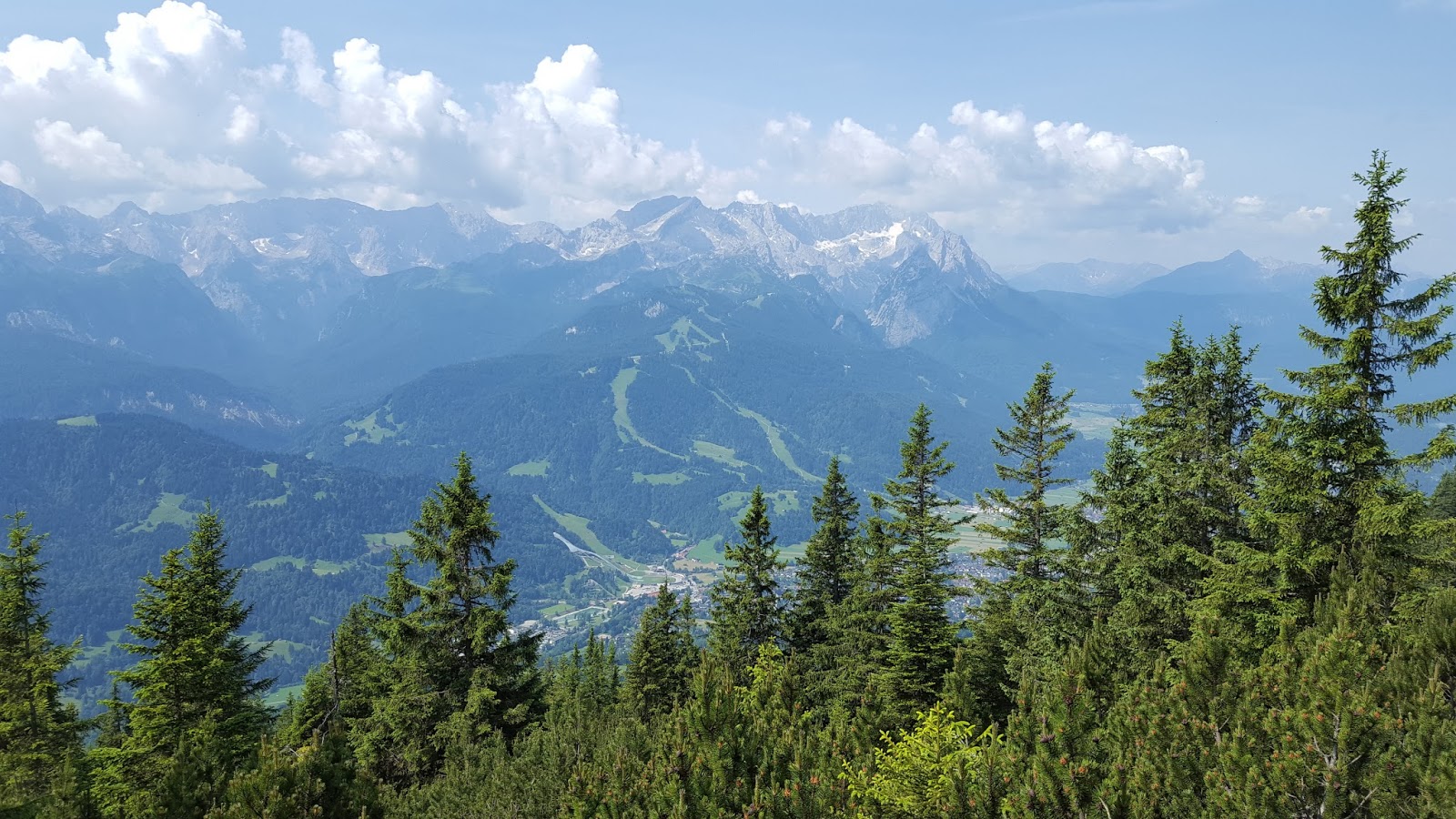
the grassy pastures at the summit offer panoramic views of the Zugspritze and the Wetterstein range. We could ride a cable car up, and hike back down. Perfect for little legs!
The Wankbahn Talstation is easy to find and offers ample parking. Apparently it can be busy, due to the easy access and stunning views, but we were there mid-week and had little company. The Wankbahn cable cars are small, so we got one to ourselves. We were able just hop in and head right up the mountain, with no wait. We stayed in the car through the mittelstation and disembarked at the bergstation. The views from the cable car are stunning.
 |
| cuddling in the cable car |
 |
| Smurf and Ivysaur riding up the cable car |
 |
| stunning views toward Zugspitze, socked in clouds |
After getting off the cable car, we gawked at the views for a while, then set off along a wide trail with even grades that descended slightly before crossing a grassy saddle to Rosswank. The pastures were not being grazed while we were there, but what an incredible scene they create! Frankie doesn't know the song
The Sound of Music, but we dispatched him to spin in the meadow singing
Do-Re-Mi. Close enough, right? We just couldn't resist. I may have even joined the fun.
 |
| looking back to the bergstation |
 |
| mountain avens (Dryas octopetala) and basil-thyme (Clinopodium acinos) |
 |
| paraglider! |
From here, the descent began, passing through low shrubby pines and eventually larger trees. Frankie took a spill and scraped up his knee, but a after a bandaid and a lollipop, was good as new. Mountains are not the best place for running with abandon, even when there is no exposure.
 |
Valeriana sp.
|
 |
| patched up knee |
 |
| hairy alpenrose (Rhododendron hirsutum) |
 |
| common spotted orchid (Dactylorhiza fuchsii) |
 |
| mountain avens (Dryas octopetala) |
We eventually came to the most gorgeous old maple tree, and concluded it was definite Smurf habitat. This was a good distraction from our growing hunger. The tree was at an intersection, marked 1/2 hour to Esterbergalm and 1 hour to Gschwandtnerbauer; we'd been planning on stopping for lunch at one of these trail-side restaurants. As at
Hoher-Kranzberg, we botched the timing somewhat. We ultimately decided to push on to Gschwandtnerbauer, even though it was further from our current location, because it would all be downhill, while the trail to Esterbergalm would involve some climbing and would be generally away from our car back at the talstation.
Finally we reached another sign indicating it was just 5 minutes to Gschwandtnerbauer. Hurray! However, in our eagerness, we rushed onward with paying much attention to the other signs. Never a good plan... But there was shaded outdoor seating, a welcome respite on this 90 degree day, and generous portions, and even a little playground that Frankie made use of, despite our protests,
but you are supposed to be resting.
After our meal, we foolishly blundered off in the wrong direction,
following the road down the hill, instead of the short trail back up to
the 5-minute junction. I kept muttering,
this doesn't seem right,
this can't be right,
before finally convincing Erwin we needed to turn back to pick up the trail
toward Gamshutte and Partenkirchen. That little diversion added 0.3 or
0.4 miles to the hike and got us all sweaty again, huffing back up
along the road to the alm.
 |
| we accidentally followed the road at the base of this pasture downhill for a bit |
 |
| back on the right trail |
We experienced some more confusion when the Gamshutte, toward which we had been following signs, never appeared. We eventually decided we'd passed its former site and it had been torn down. I googled it later, and although I don't speak German well enough to read the entire article, it appear there was a feuer, and Gamshutte burned to the ground.
 |
| suspension bridge over the Birkelsgraben |
 |
| crossing the Kesselgraben |
 |
| Sankt Anton |
 |
| the last section of trail was smooth like a sidewalk |
 |
| high-fives to celebrate Frankie completing his longest hike to date |
 |
| our route |
MapMyRide put this hike at 8.2 miles (including our little diversion down the road after lunch) with about 900 feet elevation gain and about 3,700 feet elevation loss. Frankie was thrilled to have set another new distance record, and vehemently insisted we walk into town for dinner when we got back to Mittenwald, adding another 1.4 miles to his daily tally.
Wank is definitely a fun hike, with amazing views. I really enjoyed it! I should have bought an "I 💙 Wank" shirt.


No comments:
Post a Comment