
I had planned to start this hike at the parking area on Burnt Hill Road where I turned around on my first Interloken Trail outing. I intended to hike north on the Interlaken Trail to Picnic Area Road, walk east on the road perhaps a quarter mile past Blueberry Campground, then return south via the Burnt Hill Trail to make a lollipop loop. However, as I was driving to the trailhead, following the Google map directions, I passed a sign for Blueberry Campground. I pulled over and confirmed: it was one and the same. There is day use parking there, and since Google said it was another 7 minute drive to reach the Burnt Hill Road trailhead, I changed my plans. I could save almost 15 minutes of driving by starting here. Brilliant!

Pleased with the on-the-fly adjustment, I set off southward on the Burnt Hill Trail. It was chilly and overcast. The sun made a valiant attempt to come out as I hiked along the edge of a pasture, but it never quite succeeded. I warmed up quickly, especially after the trail entered the shelter of the forest, and had to stop and adjust layers, keeping orange on top to make myself visible to bow hunters. I am never bold enough to start cold enough.


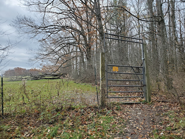
I kept the fleece ear band handy though, as the wind was howling and there are several wide open pastures along this route. Gates, like the one pictured above, keep the livestock secure, so it is very important for hikers to close each gate behind them. I think the grazing leases are seasonal, and didn't see any animals today, but I was careful nevertheless. Livestock can really tear up a nice forest.


I detoured from the footpath to wander over to the top of Burnt Hill. Peakbagger and GaiaGPS disagreed about the location of the true summit, and with the relatively large flattish top, it was hard to distinguish by eye. I walked over all possible contenders before returning to the marked trail through an oak grove with an open understory (due to the grazing).


 |
| looking west at the Matthews Road crossing |

After crossing Matthews Road, it was back in the forest for approximately 0.7 mile until I reached the intersection with the Interloken Trail. I turned left here and headed south, for the stem section of the lollipop (or string section of the balloon). I would return to this same intersection after reaching my turnaround point, but take a different route back to the car.
 |
| intersection of Interloken and Burnt Hill Trails |

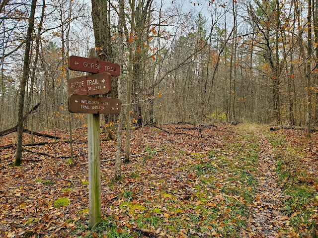
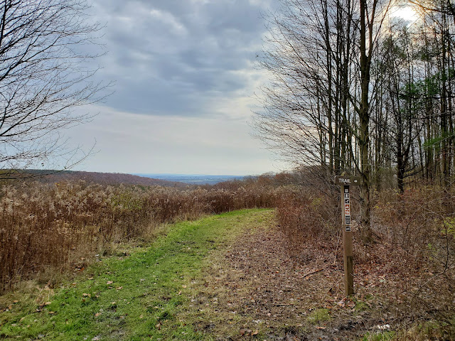
There are several more intersections along this section, but it is never confusing because the Finger Lakes National Forest has it so well-signed. The trails are also all included in GaiaGPS's free base mapping, making it very easy to tell exactly where you are at any given time. [I am a huge fan of this app! It doesn't require cell service at all -- works just as good in airplane mode -- and has base mapping that is far superior to other free apps I've tried.]
 |
| my turnaround point at the Burnt Hill Road trailhead |


After reaching my turnaround point at the Burnt Hill Road trailhead, I re-traced my steps back north on the Interloken Trail until I reached the four-way intersection I'd been to before. This time I continued straight, onto a new-to-me section of the Interloken Trail. This would take me all the way back to Picnic Area Road and form the loop portion of the hike.


 |
| looking west at the Matthews Road crossing |


 |
| looking up at the top of Burnt Hill |


 |
| looking west along Picnic Area Road |
GaiaGPS tracked this hike at 6 miles roundtrip with 575 feet elevation gain. MapMyRide also tracked 6 miles exactly, but put the elevation gain lower at 425 feet. I didn't bother calculating by hand, so I am not sure which is right, but either way, terrain change in this area is very modest. The biggest challenge I've encountered so far on Finger Lakes National Forest is the mud. The clay soils here retain moisture, and mountain bikes and horses exacerbate wear on multi-use trails. Unfortunately, many of the trails show evidence of bike damage even where it is explicitly forbidden (and clearly posted to that effect).
With a total distance of 11.2 miles, the Interloken Trail is the shortest of all the FLT Branch Trails. Due to my long drive, out-and-back hiking, and need to be back home for school pick up at 3 pm, it will take me two more outings to complete the rest of the trail. With a vehicle drop and no time constraints, the entire Interloken Trail could easily be hiked in a day.
No comments:
Post a Comment