
When traveling, we always like to have some experiences *extremely* local to where we are staying. Since we're staying in Wilmington this week, I researched hikes in the immediate vicinity. We have already done many hikes in this area on previous trips (e.g., Whiteface and Esther, Bear Den, Copperas and Owen Ponds, Cobble Lookout) and hiked Silver Lake Mountain a few days ago. But I saw Flume Knob on the map in very close proximity, and remembered seeing a trip report with pictures showing a lovely view looking right down into Wilmington. Sold!
The Flume Trail System includes both hiking and biking trails, and the trailhead on Route 86 is popular. It appeared full when we arrived, but I drive a tiny car and was able to squeeze in. There also appears to be rapid turnover, as some folks just walk down to look at the water then move on. The trail starts out fairly flat, by Adirondack standards, gaining just 300 feet in the first mile. There are many intersections, some marked but not all. I was running GaiaGPS and the base mapping illustrates the trail system, so we checked that periodically to ensure we were still on the right track.
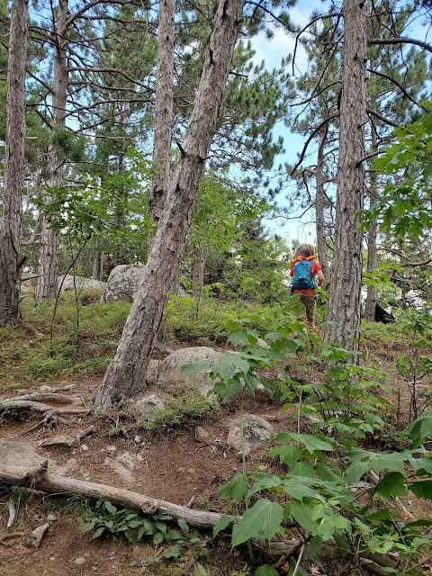
After the first gentle mile, the grade steepens considerably, and the second mile gains over 900 feet in elevation. For this portion of the hike, it is pretty clear where to go: UP. I took shockingly few pictures on the ascent. In the shot above, the terrain had leveled out, and realizing we were close to the knob, Frankie ran ahead to be the first to arrive.
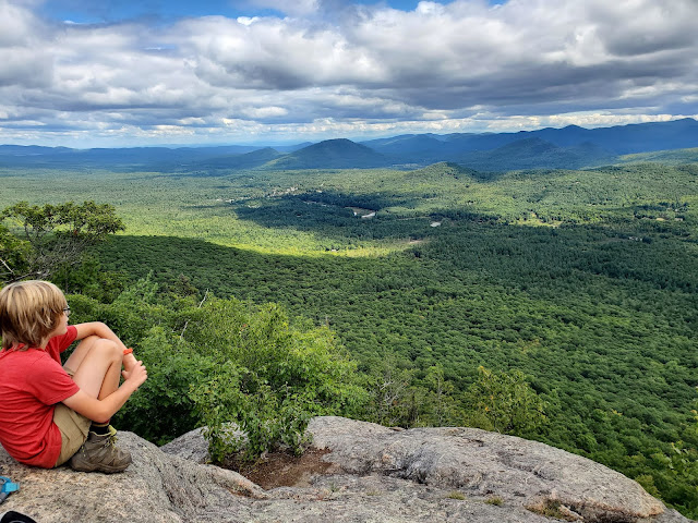


We were the only party on the knob, and hung out snacking and enjoying the view for quite some time. Frankie and I explored all the little side paths to see if they led higher up or to different views (no and no). As illustrated on the maps, the trail ends at the knob and does not continue to the nearby high point of the ridge. So... obviously I was going bushwhacking to find it. Erwin had zero interest in that, and was doing something Pokémon on his phone, so Frankie elected to stay with the screen.


It was an easy bushwhack through open forest to get up to the true high point. I walked around up on the ridge, climbing up onto several glacial erratics to make sure I touched the highest ground, then headed back down toward the knob. As I was almost back, a young welcome committee found me and took me back a more challenging way. Frankie had deep regrets about not accompanying me up onto the ridge (of course) but Erwin was chilly at this point from sitting around and ready to hike back to the trailhead, so down we went.


The boys ran much of the descent, but after gamely trying to keep up, I decided to stick to my own pace. Normally I will run along with Frankie because he likes it so much, but I was having a lot of visual disruptions from a (mercifully painless) migraine. After repeatedly scraping one leg, I realized I had a blind spot on that side... definitely not ideal for running down a mountain. I stopped to check out the designated campsite, pictured above, that is quite near the trailhead. I'm not sure I'd want to camp so close to Route 86, but you can't beat the price (free).

No comments:
Post a Comment