As with my outing last week, this was another non-contiguous section of the Finger Lakes Trail (FLT) selected because of a looming October 1 hunting closure on private land. Skipping around like this allows for the possibility of completing Map M15 this fall. I don't know whether I'll pull it off or not, but at least I have the chance now. Since I complete these solo hikes on school days between drop off and pick up, I have a fixed and limited window of time. It's such a long drive to get down to here that I am incrementally reducing the time available to hike (and therefore the distance I can cover) with each new section I hike. I keep saying I'm not going to be able to keep exploring new ground on the FLT on school days, and then I keep pushing it. I am absolutely and irrevocably hooked. Please send help.
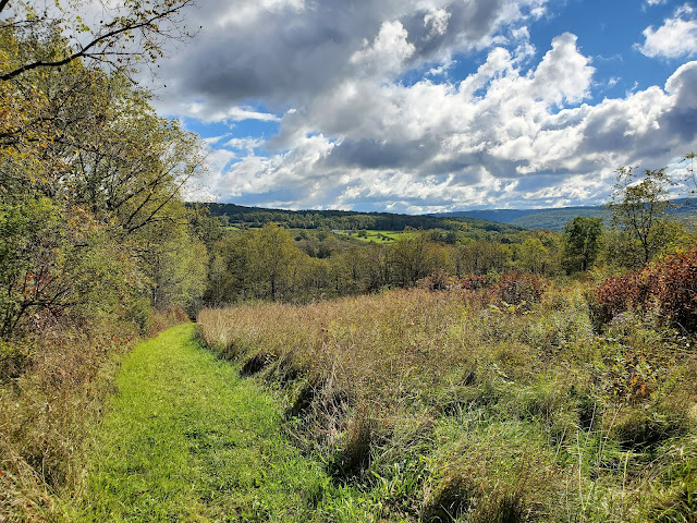
Anyway, I started at the Twin Tunnels trailhead, a name that confused me until I arrived (and then it became perfectly clear). The FLT follows a private farm from the trailhead, first through forestland, then up a little hill and through mixed pasture and hayfields. After 0.3 miles, the trail turns onto an old railroad bed for about half a mile before turning right onto single track leading uphill through forest.
 |
the eponymous Twin Tunnels
|
 |
along the old railroad bed
|
I walked past *a lot* of gypsy moth egg masses, probably more than I've ever seen before. I was down in this general area hiking in June and was shocked to see entire hillsides were completely defoliated. It looks like that could happen again next year, too. The pupae are rather unappealing.
 |
gypsy moth (Lymantria dispar) pupae and egg masses
|
The trail soon emerges from the forest into a shrubby area that is apparently an old vineyard. A short distance later the FLT passes into Finger Lakes National Forest (FLNF). This was terribly exciting for me, as I used to work for the Forest Service in Michigan and Minnesota and have an abiding fondness for the agency, yet somehow had never explored FLNF before. [Perhaps I'd subconsciously absorbed a little of the disdain by some at the Forest Service for "the farm forest."] We don't have much federal land in New York State, and the FLNF is our only National Forest; administratively it is a unit of the Green Mountain National Forest. Anyway, I was really happy to finally be checking it out.
 |
looking north at the Satterly Hill Road crossing
|
 |
looking south at the Satterly Hill Road crossing
|
 |
Forest Service map at the kisosk
|
 |
continuing eastward
|
The trail begins a significant descent at this point, gradually losing more than 300 feet down to a stream crossing with a nice high water bridge.
After crossing the bridge, the trail run alongside the creek briefly, then travels northeast through nice forest before emerging at the back side of a hayfield. The trail follows the edge of the field north and then east out to Logan Road, which was my planned turnaround point. I could see where the FLT re-enters the FLNF on the eastern side of the road, slightly north of where I emerged. From here I simply turned around and retraced my steps by the way I came.
 |
looking north at the Logan Road crossing
|
 |
looking south at the Logan Road crossing
|
 |
mud pits along the old railroad bed
|
 |
mud pits along the private farm lane
|
 |
almost back to the Twin Tunnels trailhead
|
MapMyRide tracked this out-and-back at 6.5 miles with approximately 740 feet elevation gain. It was a gorgeous day to be up on Satterly Hill with those big views from the open fields. It is a long drive, but I'll definitely be back -- I want to explore more of FLNF.


No comments:
Post a Comment