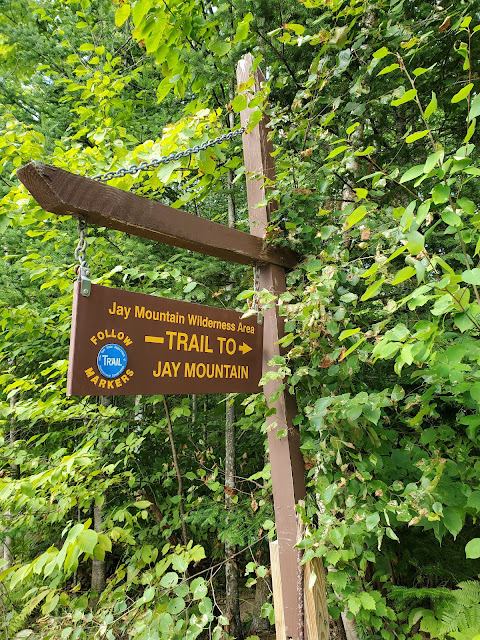
It's been a couple lower mileage (i.e., rest) days since our hike up Lower Wolfjaw, and we were ready for another bigger adventure. I had been wanting to climb Jay Mountain for years, and since we were staying in Wilmington, it seemed like a good choice: less driving than many other destinations we might have chosen. Descriptions of the Jay hike promised uncrowded trails, and a long ridge walk popping in and out of treeline, a highway in the sky. This made it easy to sell to the rest of the gang. There were just a few cars at the trailhead when we arrived and we set out in good spirits through dense forest.
The trail on the lower slopes is fairly new, and not yet eroded, soft
underfoot. The ascent through the forest is pretty much constant, but no steep scrambles or anything too challenging. We paused
little in this section, just kept powering along. We were super excited to get up on the ridgeline and planned a long break at Jay Mountain Lookout. Upon gaining the ridgeline, there is an intersection: left to the "scenic overlook 250 feet" and right to the "ridge/summit." This is also the end of the marked trail; Jay Mountain is choose your own adventure from this point forward. We turned left and headed to the Lookout for our planned break.
 |
| views to the east, toward Lake Champlain |
We spent about an hour just hanging out at the Lookout, snacking and enjoying the views. Most of that time, we had the entire summit area to ourselves. One couple came through but didn't linger, and then a solo hiker who got turned around showed up twice. We ended up showing her the way back to the marked junction on our way to the ridge beyond. We had worked up quite a sweat climbing through the forest and got chilly on the exposed Lookout; that more than anything drove us to move forward again; sometimes it's easier just to get moving again rather than dig out even more layers.
 |
| views to the west towards Whiteface, which is socked in |
After the Lookout, the trail dips back in the woods, then emerges in a meadow with goldenrods and wide views. Past that, cover is variable, with sections of small trees interspersed with huge stretches of wide open slab rock. The ridge goes on like this for almost 2 miles! It is incredible.
There are many bumps and intermediary summits along the ridge. It is easy to think a big looking one ahead is the highpoint, and then scramble along a bit further and see that the next one is even taller. The pointy bit in the picture above is not the highpoint; there is a more rounded bump behind it that is even taller.
 |
| looking back |
 |
| the summit cairn (one of several big cairns along the ridge) |
After reaching the highpoint at the end of the ridge, and verifying that the trail petered out and there were no further bumps along the ridge, Erwin was ready to stop and then head back. But I wasn't quite there yet... because the USGS mapping showed a benchmark. Of course Frankie and I were going to look for it. Bwahaha! We left Erwin to enjoy the summit and began our hunt. We found a tiny herd path leading down into the balsam. Could that lead to the benchmark? Only one way to find out. We eventually did locate the benchmark and the two numbered triangulation points, but it took some searching. Frankie really enjoyed this quest. We took the obligatory boot and benchmarks photos of all three, and checked out the spectacular views eastward from the end of the ridge, then decided we should probably go find Erwin again so he didn't start to worry.
After we started back, we met Erwin, looking for us, and Frankie was thrilled to be the tour guide and show him all that we found. We all agreed that the views here were better than at the actual highpoint, so we decided to take another break here with more snacks and layer swapping. Erwin and I draped our sweaty base layers in the sun and put on dry shirts to better enjoy the rest (unfortunately my sports bra did not dry well and felt super gross going back on, but dry was nice while it lasted).
 |
| Cindy enjoys the view |
We probably spent another hour or more here. Eventually, we decided to head back, and were treated to spectacular views heading back west along the ridge, all the way to the junction with the marked trail and the spur back to the Lookout.
 |
| back at the junction |
GaiaGPS tracked this out-and-back hike at 8.5 miles roundtrip with 2,522 feet elevation gain. Most of that gain (approximately 1,800 feet or so) comes in the first 2.5 miles, before reaching the Lookout. The remaining 700 feet comes gradually, going up and down the many bumps along the ridgeline, going both out and then back again. Very few people appear to continue past the highpoint to find the benchmarks on the far eastern end of the ridge; the herd path that descends through the balsam is very narrow and lightly trod, vanishing entirely in places. In fact, many people seem to turn back before reaching the actual highpoint, stopping at one of the many intermediate exposed bumps along the way.
This is an absolutely spectacular hike! It would be worth it just for the Lookout, but the long ridgewalk is charming beyond description. We loved every minute of our time up on Jay Mountain. Highly recommended!!


No comments:
Post a Comment