I went into this hike super excited because I would be finishing the Interloken Trail, which corresponds to Finger Lakes Trail (FLT) map sheet I1. The Interloken Trail is the shortest of the FLT branch trails, but well worth exploring. I started today on Searsburg Road, which was my turnaround point on my last Interloken Trail hike. I proceeded north for 3.8 miles until I got to Parameter Road, which is the northern end of the Interloken Trail. There is parking and a trailhead here, from which a non-FLT Forest Service trail, the No Tan Takto Trail, also heads south. The southbound No Tan Takto Trail crosses the Interloken Trail at Seneca Road, about a mile north of my car, so I decided to return that way and make a loop.
My route is shown below in orange; the blue track at the bottom is from my previous hike here in January. If you notice the straight spur heading east on Seneca Road from the trail crossing, that is not a GPS error. I walked that section of dirt road out-and-back after noticing that the highpoint of Seneca County is there. Highpointing is not a goal I am pursuing, but I was right there -- might as well tag it.
There was no snow at home, but as I drove south, the hills began whitening, and there was plenty of snow when I arrived at the trailhead. I wasn't exactly thrilled to see the snow, because I'm obsessed with spring wildflowers this time of year, but I knew it would melt off fast with the mild temperatures and hot sun.
 |
trailhead on Searsburg Road
|
 |
northbound through a pasture
|
It's a varied mile or mile-and-a-half to the first road crossing, as the trail passes through pasture, then forest, then along the west side of Teeter Pond.
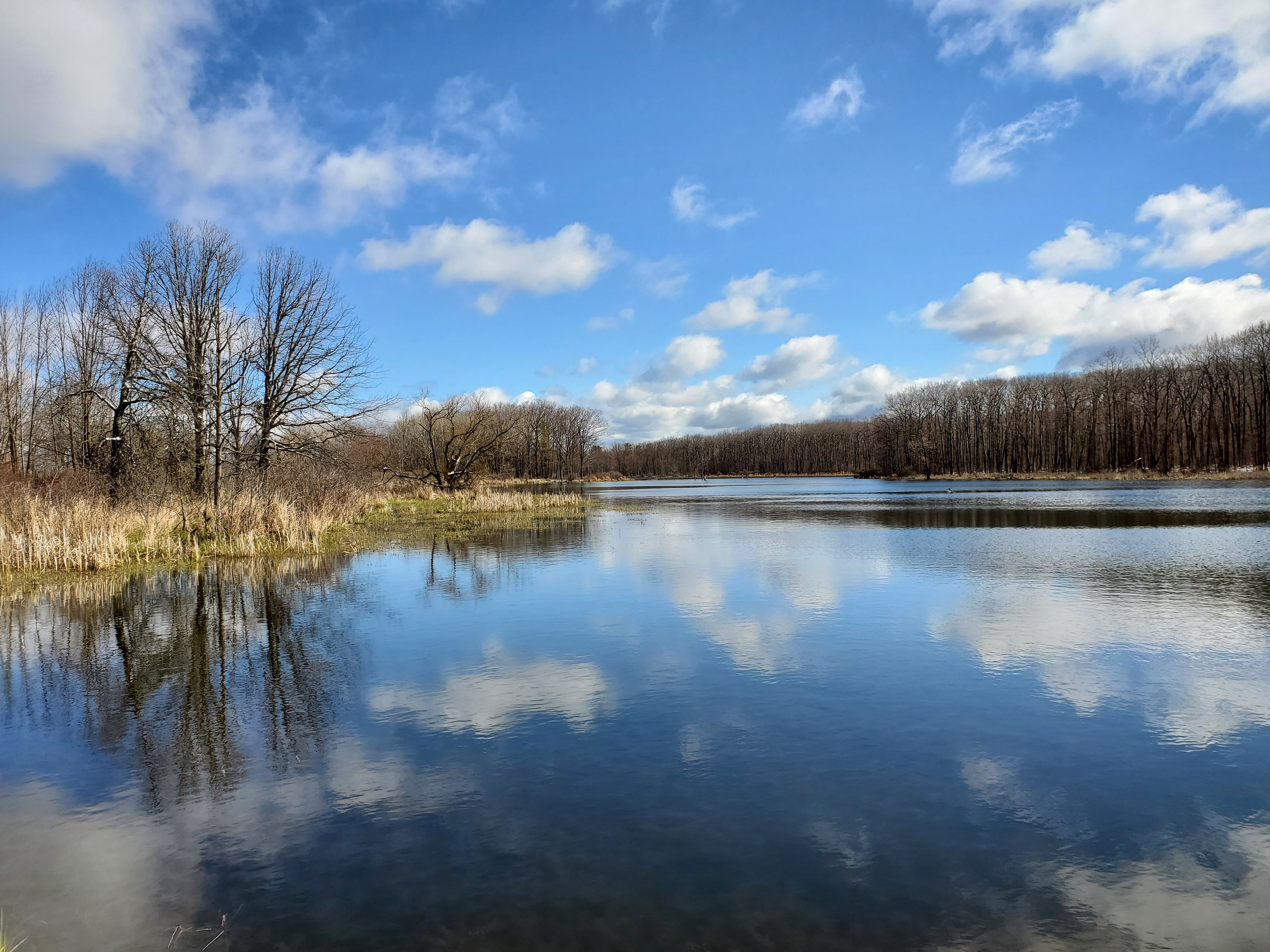
 |
Teeter Pond
|
The short segment of trail between Teeter Pond and the parking lot on Seneca Road is very muddy. Finger Lakes National Forest has been very muddy in general, every time I've hiked here. Today was wet, of course, with all the snow melt, but not as bad as I expected. The large parking lot on Seneca Road suggests that this area gets a lot of use. The clay soils here compact easily under heavy use by horses and mountain bikes.
 |
large parking area on Seneca Road
|
 |
looking west at Searsburg Road crossing
|
 |
continuing north across another pasture
|
 |
back in the forest
|
 |
American fly honeysuckle (Lonicera canadensis)
|
 |
looking west along Wilkens/Townsend Road
|
The section just north of Wilkens/Townsend Road is the least charming, as crushed stone has been brought in, presumably to help with the mud. However, it makes the wide trail feel more like a road. I was relived to get off the little rocks and back onto soil.
 |
looking west along Parameter Road
|
 |
the northern terminus of the Interloken Trail
|
 |
starting south on the No Tan Takto Trail
|
 |
entering a pasture
|
 |
looking back
|
 |
the No Tan Takto Trail follows Townsend Road west for a short distance
|
 |
turning back off the road
|
I had initially thought, since I'm on public land, that I might diverge from the trail and bushwack southeast toward the highpoint on Seneca Road, to reduce the roadwalk. However, I didn't do that because I was in an active pasture, and wanted to exit via the gates provided for hikers. I've crossed many a fence in my day and these multi-strand barbed wire fences are more challenging than some. It was also not a good day to contemplate rolling under; much too wet. No matter, it was a quick stroll down a completely undeveloped dirt road. The highpoint is wholly unremarkable. Then back to the trail crossing, through the mud to get to Teeter Pond, and the short return hike to the car.
 |
looking west along Seneca Road from the county highpoint
|
 |
Teeter Pond
|
 |
back where I started -- hardly any snow left!
|
GaiaGPS tracked this hike at 8.7 miles with almost 500 feet elevation gain. Of this, 5.1 miles were on the FLT branch trail and 3.6 miles on Forest Service trails and seasonal dirt roads. Another great day out exploring!


No comments:
Post a Comment