
As I've written before, Frankie is absolutely obsessed with fire towers. I wanted to check out one of the Catskill towers, and when we found out that one of the approaches for Balsam Lake Mountain is via the Finger Lakes Trail (FLT), that rose to the top of the list. We invited Erin and Alden to join us, and that pushed the excitement levels through the roof. A fire tower cousin hike? For my kid, that is about the pinnacle of awesomeness. My excitement levels were also quite high, as I can't recollect EVER hiking in the Catskills before (plus the whole FLT thing).
The drive down was a little rough; poor Alden struggles with motion sickness and was completely fine until we got off the highway and started down the twisty back roads to the trailhead, and then he wasn't. I had the same issue as a kid and always feel so sad for him. Vomiting on the way to the trailhead is not a great way to start a hike. He is apparently used to it, though, and was very cheerful once we arrived at the parking area at the end of Turnwood Road. We had the kids take off their masks and space out for a quick snack before heading up, since it was a long drive.


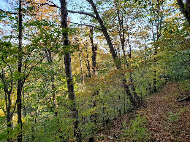
The first section of our route was along the Dry Brook Ridge Trail, which is marked with blue disks, as shown on the FLT mapping for Map Sheet M32. This section had a steady but gentle incline, as shown above. After 0.9 miles, we came to a junction and turned left onto the Balsam Lake Mountain Trail, marked with red disks (also part of the FLT). The red trail is much more rugged; nothing that qualifies a scramble, to Frankie's dismay, but it is rocky and much steeper.


After gaining more than 700 feet in 0.6 miles, we reached the next intersection. The Finger Lakes Trail continues to the left, but we turned right to get to the fire tower. Knowing we were almost there, with just a short, flat ridge walk remaining, Frankie's summit fever set in. We let the boys run ahead with direction to wait for us before climbing the tower.


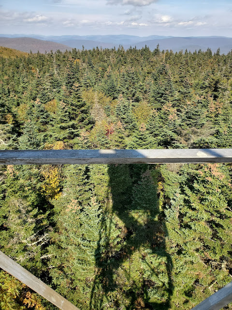
Of course we climbed up at the soonest opportunity, which wasn't immediately because the small summit clearing was fairly crowded, but soon enough. Unfortunately the cab was locked, so we couldn't go inside. This is always a disappointment, but somewhat understandable. The summit steward explained that the windows don't open, so they are keeping it closed during COVID. Probably not a bad idea given how many people were up there -- somewhat surprising given how few people we'd seen on the hike up, but of course there are several approaches.


There are still nice views available from the stairs. It's not quite the same because only the highest levels are above the treeline and the tower itself obscures part of the views, but hey. What are you gonna do? Like it! I hope to come back to hike the adjacent section of the FLT so can always climb the tower again then.

 |
| evidence shot: lots of people at the small treed summit |

After climbing the tower and snacking (we went apple picking yesterday, so apples and cider donuts for all!) and finding the benchmark, we were ready to head down. Instead of returning the same way we came, we left the summit via the Balsam Lake Mountain Trail to the east, to make a loop.


This eventually teed onto the Dry Brook Ridge Trail, onto which we turned right and followed all the way back to the parking lot. We passed the first intersection with the Balsam Lake Mountain Trail, meaning the last 0.9 miles was the same as the first -- back on the FLT.


I tracked this hike using both MapMyRide and GaiaGPS (free versions of both) and got somewhat variable data: 4.9 miles with 1,205 feet gain in MapMyRide and 4.5 miles with 1,180 feet gain in GaiaGPS. I think the Gaia values are more accurate, although both have some "extra" because I don't bother pausing them at the summit (up and down the tower, around the summit, looking for the benchmark, etc.). The GaiaGPS app is really growing on me, especially for use in terrain, because the base mapping is so much better than in MapMyRide.

No comments:
Post a Comment