
Benbulben Mountain is an iconic part of the landscape in County Sligo, a great dramatic table top visible from miles in every direction. It is part of the Dartry Mountain Range, the most distinct of a series of limestone peaks sculpted by glaciers during the last ice age. Erwin had read that we couldn't climb Benbulben, but we were still drawn to the unique formation. [This turned out to be incorrect, as it can apparently be climbed fairly readily from the south side, although parking/access can be a problem.] Anyway, we decided to hike the Benbulben Forest Walk, an easy 5.5-kilometer loop that runs along the base of the mountain. Because it is such a short hike, we spent the morning exploring charming Sligo town before heading out. The boys caught a bunch of Squirtles with sunglasses (it was a Pokémon Go community day) while I got a nice spot of tea, we left a bookstore with far more weight than is reasonable to fly back over the Atlantic, and had a delicious lunch at Hooked.
Fortified for our hike, we drove 15 minutes north to the car park at the Gortarowey Forest Recreation Area. This is a good sized lot, but was almost full when we arrived in the early afternoon; we got the very last spot. This area is owned by Coillte, a forestry company that manages 7% of Ireland's land. It is so refreshing to have a private company encourage public recreation on their property... we don't find much of that in the States. The car park is posted with a large map, which is also available at the company website. Thank you, Coillte! Additional information about the hike, including several more maps, is available at the super useful Sligo Walks site.
We started with the short all-access route immediately out of the car park, just because I knew if we saved it for later, we wouldn't end up bothering and I was curious to see the marked viewpoint. This was somewhat overgrown, and much better views are available down the red-blazed Benbulben Walk trail. There is a view of Benbulben looming over the car park at the end of the all access trail.

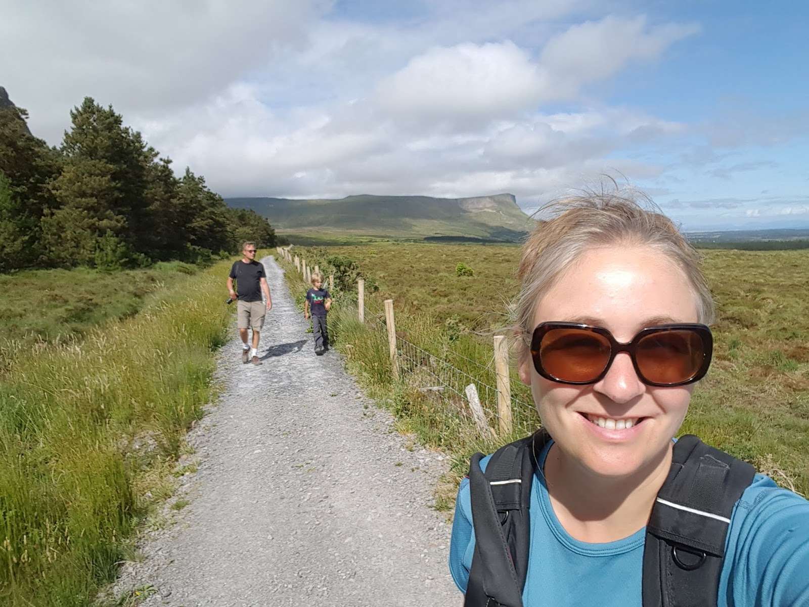
Having scratched that itch, we set off along the red trail. The first couple hundred meters aren't terribly interesting, as the trail follows a dirt road up a slight hill through thick forests. This section is short though, and soon after passing a house on the right, things start getting a whole lot better as Benbulben becomes more and more visible.

This is active timberland, which can make the mapping a little confusing, as some of the areas depicted as forested have been recently harvested. Where the above photo was taken, there is a large clearcut immediately adjacent to the trail on the left (northwest). But with Benbulben rising grandly to the right, no one is looking left.
 |
| rosebay willowherb, a.k.a. fireweed (Chamaenerion angustifolium) growing in the clearcut |


The trail continues northeast, getting closer and closer to Benbulben, and then after passing through a kissing gate, running parallel to the mountain, offering close up views of the rugged north face.


Eventually the trail slopes down gently and enters the forest, emerging again for more dramatic views of Benbulben. And those little windswept trees!


Near the end of the mountain, the trail turns west-northwest, and faces sweeping views out to see. We had fantastic clear skies and could see over Donegal Bay up to Slieve League and beyond to the north.


 |
| looking back toward Benbulben |


 |
| great willowherb (Epilobium hirsutum) |

After popping briefly out onto a rural lane, the trail re-enters the forest and then climbs gently into another clearcut. Not long into the clearcut section, there is a sign and a short spur trail leading to the ruins of a cashel, or a medieval ringfort. This is an incredible spot, with views southwest to Knocknarea and beyond. We could see Queen Medb's Cairn and several other megalthic tombs dotting nearby hilltops.


 |
| spur trail to the cashel |
 |
| looking toward Benbulben from inside the cashel |
 |
| view of Knocknarea from the cashel |

The trail re-enters the woods at the far edge of the clearcut and we shortly arrived back at the car park, with me taking slightly longer than the boys after getting distracted by horsetails.
 |
| great horsetail (Equisetum telmateia) |

 |
| we followed the red trail |
No comments:
Post a Comment