
Frankie very much likes it when Erwin comes hiking with us, but it complicates trail selection, since he prefers shorter hikes with water features and minimal elevation gain. The Finger Lakes Trail (FLT) is pretty much *all* up and down, up and down. I love it, but Erwin, not so much, and after getting dragged along on a few hikes at Morgan Hill that were tougher than he wanted, he was firm in negotiating this time: we'd just have to turn back after 3 miles. I decided on Hoxie Gorge, because it has some super charming streams, and I have already hiked the entire FLT through Hoxie Gorge, so wouldn't fret about orphaning part of the trail due to a premature turnaround.
We parked at the McDermott Nature Trail lot, which was alarmingly almost full. We had our masks, of course, but after all the isolation, the others are a bit intimidating. Luckily, we encountered very few people on the FLT (they may have gone the other way, or been using the McDermott Nature Trails proper). We followed the spur trail along the creek, and I was pleased to find many wildflowers blooming. The boys blew by me whenever I stopped to admire them.
 |
| hobblebush (Viburnum lantanoides) |

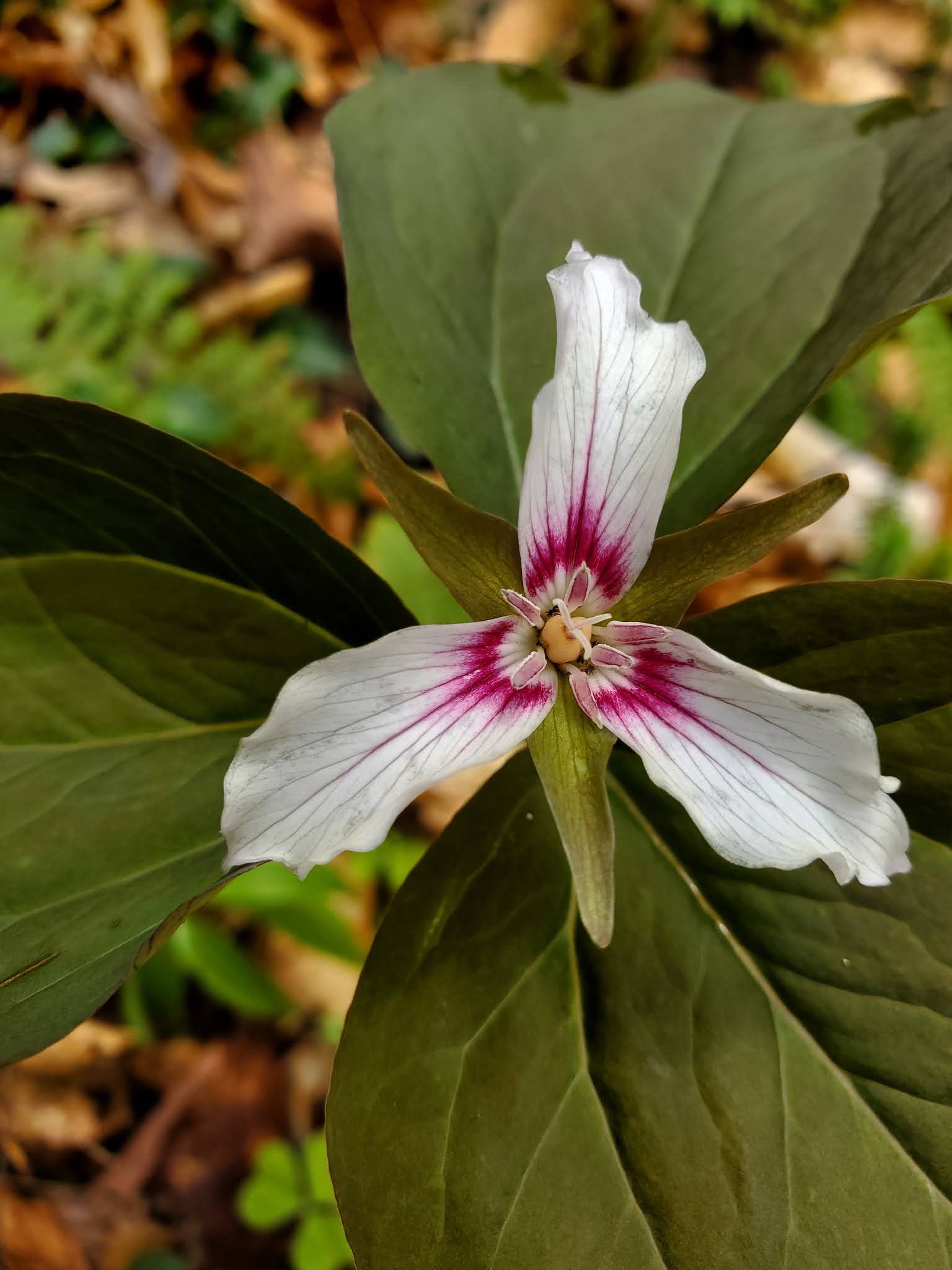 |
| painted trillium (Trillium undulatum) |
 |
| wild oats (Uvularia sessilifolia) |


 |
| marsh marigold (Caltha palustris) |

 |
| barren strawberry (Geum fragarioides) |

I was running MapMyRide, of course, but had the volume muted, as I don't
care for the noisy mileage updates. This allowed me to push us
slightly past the 3-mile mark, which was up on a ridge that the trail
was descending (pictured above). I knew there was a lovely stream at the bottom of the
hill that would make a nice destination to hang out for a while before
starting the hike back. Totally worth it!


We hung out here for quite a long time. Everyone had a snack, and Frankie threw approximately one million rocks, and I poked around, flipping rocks. Found a red-backed salamander and approximately one million fossils, and a crayfish. It was a truly delightful place to be! Eventually we packed up and headed back the way we came.


MapMyRide tracked this hike at 6.5 miles with a little more than 800 feet elevation gain. For pictures of this area in the fall, see the trip report from a solo outing in October 2017 where I hiked a slightly longer version of this same route.
No comments:
Post a Comment