When I was reviewing online trail maps before my recent Art Park
hike, I discovered there is another cross-country section of the North Country National Scenic Trail (NCT) just a mile or so down Stone Quarry Road from where I turned around on that hike. I didn't have time to go further that day, because I needed to get back in time to pick Frankie up from school. Also, I'm not remotely interested in hiking on roads. However, I am definitely interested in exploring new trails. Between that hike and the one we did today, I've definitely got the bug to keep exploring new sections of the NCT. We hiked a few sections of the NCT last summer, and Frankie was enthusiastically and affectionately calling it "the interstate trail" (he loves highways), so I thought he'd be excited to hike more of it today. Plus I saw pictures of the foot bridge over Chittenango Creek, and I knew he'd like that. Pooh sticks!
This section of trail follows an old railroad bed through Nelson Swamp Unique Area. I love the concept, but rail trails conversions aren't usually terribly interesting for hiking -- although I often find them more appealing on a bike. The beginning of this trail is no exception, starting out arrow-straight and perfectly level. Long sight lines seem to make a trail feel monotonous, even if it's actually not. I also feel a sensation of separation from being elevated, as if I'm only passing through the woods, but am not actually
in the woods. And yes, I realize that sounds a little crazy. Nevertheless, I want to be in the woods! Rationally, being elevated is a good thing in this case, because the trail goes right through a massive wetland. The old rail bed affords hikers dry passage through the swamp with adversely impacting the wetland or the rare plants that grow there.
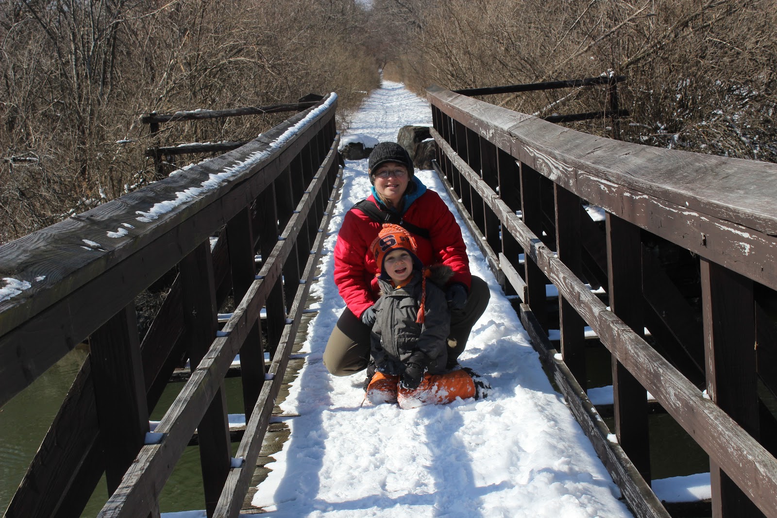
There are two bridges along this section of trail, the first over a fast-flowing tributary, and the second larger bridge over the slow-flowing and bloated Chittenango Creek. There were spectacularly odd ice formations at the edges of the water, which fascinated me, and Frankie was thrilled to finally play Pooh sticks. This is a game from the A.A. Milne book, where multiple players drop sticks from the upstream side of the bridge; the player whose stick emerges on the downstream side of the bridge first wins. Because we hiked this as an out-and-back, we played four separate rounds of Pooh sticks. This prolonged our outing considerably, but I can think of many worse things than hanging out in such a beautiful place.
 |
| yellow birch (Betula alleghaniensis) |
 |
| bridge over Chittenango Creek |
 |
| Chittenango Creek, looking downstream (southwest) |
 |
| Chittenango Creek, looking upstream (northeast) |
 |
| Pooh and Piglet |
 |
| playing Pooh sticks |
 |
| jumping for joy |
 |
| red osier dogwood (Cornus sericea) |
 |
| bark beetle handiwork |
 |
| the Fenner wind turbines in the distance |
 |
| the cross-country segment ends at Hardscrabble Road |
 |
| I told Frankie we had to throw a snowball in the road before turning back |
 |
| this turned out to be a great idea |
 |
| checking out an old springhouse |
 |
| checking out an old bird nest |
 |
| giving sticks a bath -- this was an elaborate activity he devised while I was looking at ice |
 |
| the interpretive trail is a small loop that goes by a faster flowing section of Chittenango Creek |
This map from the New York State Department of Environmental Conservation illustrates our route. We started at the parking area on Constantine Bridge Road and followed the Link Trail "hiking trail" all the way to Hardscrabble Road, then turned around. On the way back we took followed the "universal access trail" spur, which loops south to the river before rejoining the main trail. MapMyRide tracked the hike at 3.6 miles round trip.


How fun!!!
ReplyDeleteLove coming along!!
ReplyDelete