Erwin doesn't hike with us very often because he operates on a completely different schedule. However, he does enjoy hiking and is prone to the inevitable restlessness pulling so strongly toward the outdoors this time of year. When he saw today's weather forecast for unseasonably warm temperatures, he decided to sacrifice some sleep and come out for a hike with me. As soon as he mentioned the idea, I knew immediately where I wanted to go! The Skyline Trail is 6.1 miles. I've wanted to hike this trail for a long time, but logistically, it hasn't been feasible, since it is beyond Frankie's current range. To accomplish it solo, I'd have to do an out-an-back totaling over 12 miles with significant elevation gain, which is not something I could realistically do in the window between dropping Frankie off at school and when I'd need to be back to pick him up. Two cars would let us complete this hike as a traverse, making the distance more manageable in our available time window.
The Skyline Trail runs between Heiberg Forest and Labrador Hollow. I've included the map I tracked on my phone at the bottom of this post. To plan the hike, I used mapping and information from the
CNY Hiking and
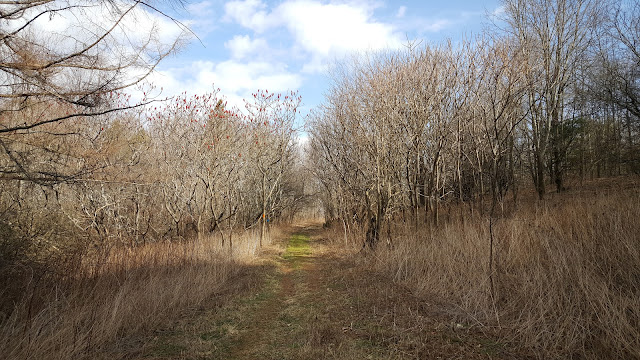
Finger Lakes Trail sites. We dropped a car at the parking area for Tinker Falls, then drove around to the small parking area on Maple Ridge Road. We've parked here before to hike the Nature Trail on the west side of the road and explore the drainage to the north, but never ventured east. The trail starts out blazed in both orange and blue, and follows an old logging road up a hill through successional forests. After topping the hill, the trail turns south and follows a single-track through northern hardwoods, with a clearcut evident on private land to the east.
 |
| the trail starts on the east side of Maple Ridge Road, across from the parking lot |
Near the southern end of the the clearcut the trail diverges. The
blue blazes continue southward (right at the split); I am not sure where
this trail goes. The Skyline Trail follows the orange blazes to the
east (left at the split) and heads down towards a gorgeous little pond.
After descending to the pond, the trail turns northward and follows the
shoreline into a hemlock swamp before turning east again and climbing
through more northern hardwoods.
 |
| shining clubmoss (Huperzia lucidula) |
After descending the other side of the
hill, the trail crosses Tully Truxton Road and passes under a big power
line. There is a snowmobile trail under the power line and a seasonal
road, and for the first time we saw no orange blazes. We soon
determined we had to follow the dirt road east for a short distance
before the orange blazes turned left into Kettlebail State Forest.
 |
| heading toward the Tully Truxton Road crossing |
 |
| the trail briefly follows Kettlebail Road before turning east into State Forest lands |
Here
the trail follows, then crosses, a charming little creek and climbs
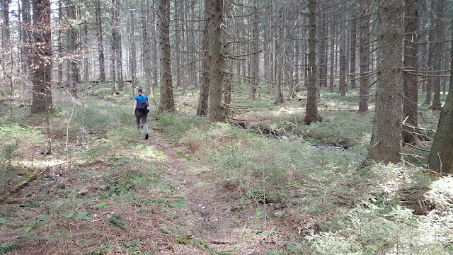
through a Norway spruce plantation lush with self-seeded understory regeneration. Normally plantations don't feel
terribly special, with the monoculture canopies and a lack of herbaceous diversity. However, this place felt almost magical, perhaps simply because the overall landscape is generally devoid of
green this time of year. Near the crest of the hill, the trail re-enters hardwoods, and passes an old stone wall and other signs of early settlers.
 |
| it is mind boggling to think about the challenges early settlers faced trying to farm these rocky hills |
 |
| another human remnant |
The descent down to Labrador Hollow is remarkably steep for CNY: the trail drops over 700 feet in less than a mile. It is never tricky footing, as the trail makes use of terraced switchbacks to navigate downward, but the glacial-sculpted terrain is certainly impressive. With no leaf cover, there are partially obscured views into the valley and northward, and Labrador Pond grows ever larger as height is lost. At the base of the hill, the trail comes out onto Markham Hollow Road, which it follows briefly northward before turning east again on a single-track from a small roadside parking area. The trail through the Unique Area doesn't make use of the boardwalk loop through the wetland or go down to the shore of the pond, but these would both be easy optional add-ons if not on a schedule.
 |
| Erwin rounding the corner of one of the switchbacks heading down to Labrador Hollow |
 |
| looking back up slope; no pictures I took captured the true steepness of this section |
 |
| crossing Markham Hollow Road |
 |
| vernal pool |
 |
| the clearing on the top of the ridge is the hang glider launch at Jones Hill |
 |
| wild cucumber (Echinocystis lobata) |
The trail pops out onto Labrador Crossroad near the eastern end to make use of the bridge over the stream/wetland complex, then crosses Route 91 and re-enters the woods. Here the terrain is again steeply sloped, but the trail only climbs a short distance before turning north and cutting cross-slope for the remaining distance back to the Tinker Falls parking area. The road is in sight of the trail for this entire section. Knowing this in advance didn't deter me, as I wanted to explore the entire Skyline Trail, but I might skip this section on future hikes, leaving the second car at the main parking lot for Labrador Hollow. We passed a kiosk there with a big trail map, but there is no mention of the Skyline Trail on the new signs at the Tinker Falls trailhead.
 |
| field north of Labrador Crossroad |
This is a great hike! The hills southeast of Tully are just so beautiful. I'll definitely be looking for more trails in this area to explore in the future.


What a great hike. My heath probably would make this impossible. Maybe someday?
ReplyDelete