
While driving home from our hike at Cazenovia Gorge yesterday, we passed a sign for Woodchuck Hill Preserve, which I've driven by many times but never visited. I asked my Mom about it, and she'd never been either. However, she reminisced fondly about long ago hikes at nearby White Lake, which is on private land and hasn't had public access within my memory. Last night I looked Woodchuck Hill Preserve up online, and found a trail map. I remembered that I'd done this research before, but never ended up actually going because the trail system is so limited. The preserve is small; the longest trail is just 0.8 miles. However, for my Mom with her bad hip, it looked pretty ideal. She was particularly intrigued by the blue trail, which is illustrated as an extremely short spur running to the western property line. It is marked on the map as a hiking trail, and appears to head directly in the direction of White Lake. So we decided to go and check it out today.
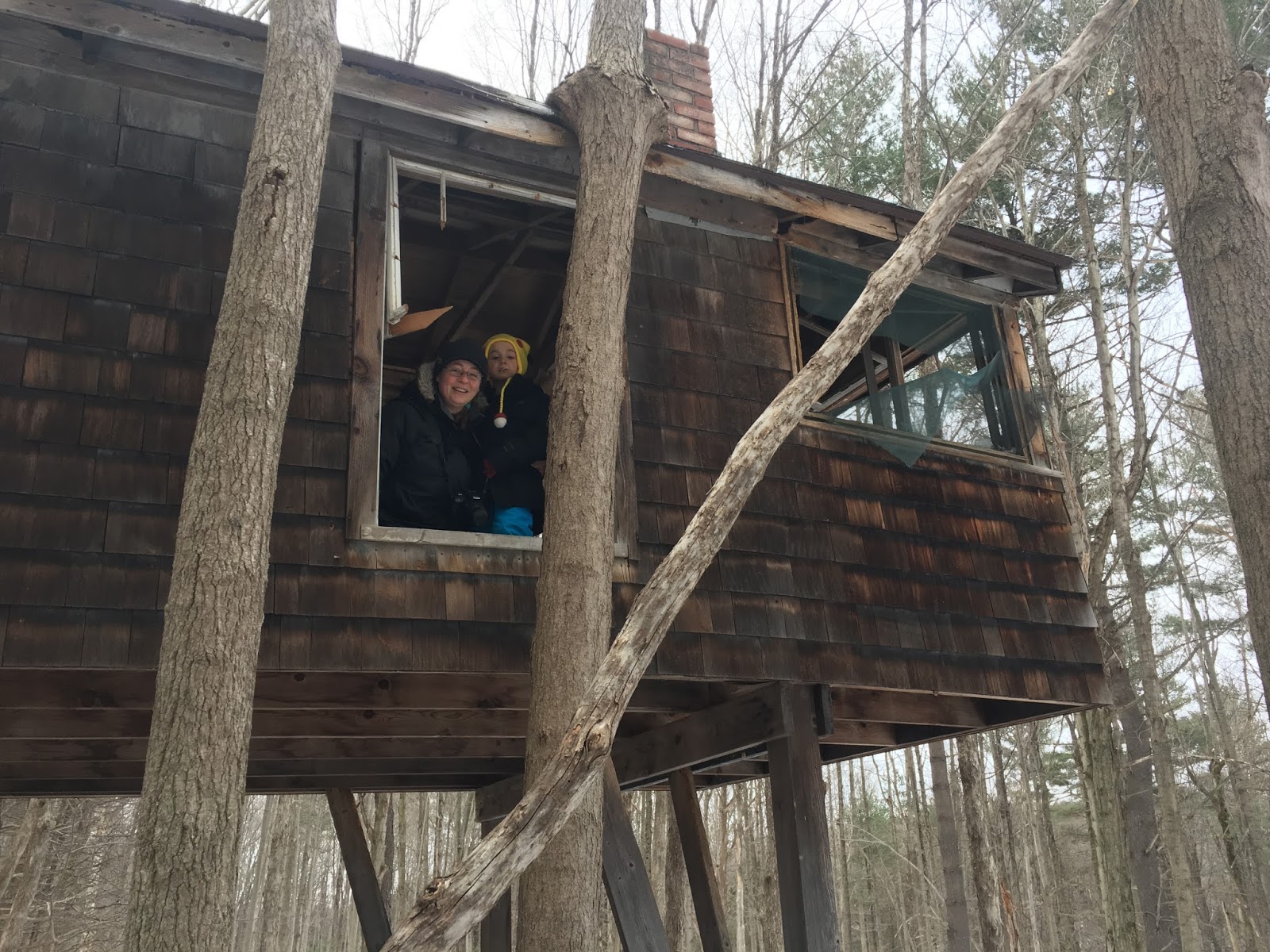
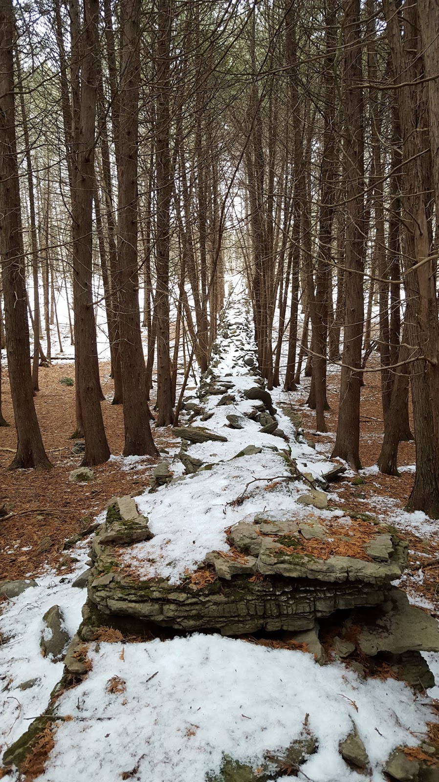
My Mom was very driven to see if we could get to White Lake, so we took the yellow trail west from the parking lot. The woods are very nice, with rocky outcrops typical of the escarpment, and old stone walls telling stories of the hardships faced by early settlers trying to eke sustenance from the land. After about 0.2 miles, there was a structure visible through the trees, a tree house of sorts, or a miniature cabin on stilts. Of course we went to check it out (there were no signs restricting access). Frankie was thoroughly enamored, but since Mary and Keith didn't attempt the climb up, we didn't linger, and I promised to bring Frankie back another time.
We turned onto the blue trail and followed it until we reached a sign marking the edge of the preserve. The trail continued, and there was a complete lack of signs prohibiting access, so we kept going. We came to the edge of a frozen water feature, filled with Phragmites, which horrified my Mom, because of course none was there 45 years ago. Keith went out a bit on the ice to look around, while my Mom continued west along the shoreline. Keith let Frankie and I know it was safe, then hurried to catch up with my Mom. Of course Frankie wanted to go on the ice, too, so we did. When we caught back up, Mary was resting alone near a big red ribbon. Keith had gone on ahead to scout. With the pain in her hips, she decided the ribbon was a sign to stop unless Keith found something remarkable on his a five-minute forward scouting mission. Frankie had a snack while we waited, and my Mom and I looked at maps on my phone, determining that we'd just gotten to the eastern-most part of the White Lake basin (I was running MapMyRide). When Keith returned, he reported more of the same in the near-ahead, so we turned back, re-tracing our steps to the parking area for an out-and-back totaling 1.8 miles.
Mary was disappointed that we didn't make it to White Lake proper (she'd always entered via a different access point that no longer exists). However, we all enjoyed exploring a new place, and I will gladly honor my promise to take Frankie back another time. We have the rest of the yellow trail to explore, and apparently could continue further on the unmarked trail we explored today. Maybe we'll even find the elusive White Lake someday.


 |
| the yellow trail |

 |
| photo by Mary |
 |
| photo by Mary |

 |
| the only access to the cabin was up these icy boards |


 |
| our turnaround ribbon |

 |
| Charmander |


No comments:
Post a Comment