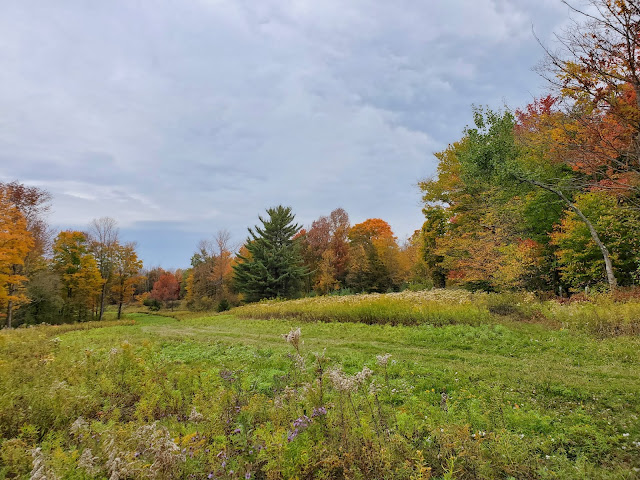
For this hike on the Finger Lakes Trail (FLT), I parked in the small lot that I had scouted on my last hike in the area, when I used the Bamberry Road crossing as a turnaround point. Today I headed east from here, planning to turn back at either the Ratville Road or Ridge Road crossing, depending on conditions. I knew rain was coming; the weather app gave a 100% chance of rain by mid-morning and I could see the storm moving toward me on the radar. But after missing a solo hike last week, I was determined to get out today. Temperatures were mild and I brought my rain gear. No biggie.
The first part of the hike is within Mariposa State Forest and passes through pine plantations with enough hardwoods in the understory to provide some nice color.
After a few tenths of a mile, I reached the junction with the Link Trail. I have hiked a significant chunk of the Link Trail further north, the portion that carries the North Country National Scenic Trail from Tioughnioga Wildlife Management Area up to the Erie Canal. I was very pleased to see its southern terminus and am definitely interested to hike the parts I haven't seen yet -- another time. Today I was continuing eastward on the FLT.
A short distance further, the FLT enters private property (thank you, kind landowners). This area used to have a hunting closure but according to the FLT trail conditions notices, the closure was lifted. I am grateful for the autumn access, because the trail skirts the perimeters of several hayfields, affording views out over the valleys and hills cloaked in the colors of the season. A perfect time to hike here!
The trail makes a 90 turn to the left (east) at the edge of the field pictured above and follows an old road labeled "4WD Rd" on the FLT map, pictured below. It would be very overgrown for a vehicle, but makes a lovely footpath.
The rain started before I reached Ratville Road. The FLT mapping shows limited shoulder parking at this crossing, and I found it to be limited indeed: narrow with a ditches. This might work for some vehicles, but my car doesn't have four-wheel drive or the best clearance. I wasn't eager to park there on a future hike, so I decided to continue on to Ridge Road.
 |
| looking southwest down Ratville Road |
The FLT is now back on public land, having entered Bucks Brook State Forest just north of Ratville Road. The trail runs along an old stone wall for quite a ways. It was really pouring by this point.
Finally I reached Ridge Road. This is another seasonal road, but much wider and smoother surfaced, so I felt better about my prospects of parking here on a future hike.
 |
| Ridge Road, looking south |
 |
| Ridge Road, looking north |
 |
| fan groundcedar (Diphasiastrum digitatum) with red maple (Acer rubrum) leaves |
 |
| multiflora rose (Rosa multiflora) |
 |
| Bamberry Road |


No comments:
Post a Comment