We have been coming up to the High Peaks region at this time of year for a long, long time, and always like to mix it up, hiking both big and smaller mountains, and squeezing in a paddle, too, if we can manage. This year I was eager to check out Bear Den Mountain, which I learned of through its inclusion in the Lake Placid 9'er hiking challenge, which describes the peak as "a hidden gem." An off-the-beaten-path destination was exactly what we wanted for the holiday weekend, so I added Bear Den to our itinerary. And boy, did it deliver!
Bear Den is situated on a flank of Whiteface, north of the bulk of the High Peaks. The trailhead is located within the Whiteface Ski Resort complex; turn right after crossing the bridge and follow the signs. A very short portion of the trail at the start is shared with mountain bikes as part of the Flume network of trails, and is blazed blue. This lower part of the trail is easy, not exactly flat, but Adirondack flat. Then the yellow blazed Bear Den Trail forks left, and gets considerably steeper. The trail feels new. Despite the steep terrain, the trail is not eroded. It is charmingly narrow and is soft underfoot: very pleasant hiking.
By the time the next fork in the trail is reached, where the above sign is posted, the grade has eased and the summit is close. We paused to check out a beautiful ledge where other hikers were congregated, but could easily see a higher ledge beyond, so re-entered the woods and continued on. This portion of the trail is blazed with small red square markers.
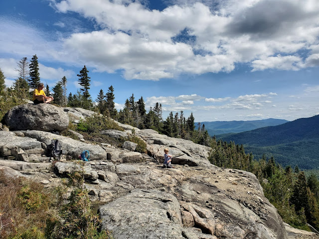
When we came out onto the higher ledge, there were two hikers there, but they quickly departed, returning to the rest of their crew on the lower ledge. We explored a bit, confirmed that there was no more up, and settled in for some summit time.
After he finished eating, Frankie devised some sort of game with a stick and rocks that kept him entertained for a long time. We didn't know if there were trails below, so didn't let him throw or hit the rocks off the ledge, but once he got over the initial disappointment, he was endlessly happy.
At some point, I asked Frankie if he could climb up on a boulder. I knew he could, but thought a challenge would better lure him away from the enthralling rock and stick combo. Once he scrambled up, he immediately flung out his arms, and shouted "I'm king of the world!" This took me by surprise, as he's never seen the Titanic movie and it's not something Erwin and I go around saying. I can't decide if it's pure instinct, or just part of the cultural vernacular. Either way, I snapped a photo and I couldn't have posed him better...
 |
| "I'm king of the world!" |
 |
| "number one" |
He immediately went back to the stick and rock fun. Kids seriously have *zero* need for toys.
Finally, after more than an hour of enjoying this spectacular place all to ourselves, Erwin decided we needed to head down. Frankie and I were a bit reluctant, but Frankie was convinced with the promise of mini-golf in town, so I acquiesced. Descent was fairly quick because of the soft dirt path, much quicker and easier than slick slab rock under running water.
MapMyRide tracked this hike at 3.6 miles round trip with 1,316 feet elevation gain (including my numerous laps around the summit). This is very close to the mileage and elevation gain posted above at the trailhead sign above. When I researched the hike ahead of time, I found a lot of conflicting information online, with some sources saying the trail is longer with more gain. Perhaps this is related to the trail looking so new? Maybe the trail was re-routed and the old trail was longer. Either way, this hike is fantastic and well worth the effort.


No comments:
Post a Comment